Let's meet
Level 16, Wisma UOA Damansara II, No 6, Changkat Semantan, Bukit Damansara Kuala Lumpur, 50490 Malaysia
This is why aerial virtual tours, 360 tours, drone visuals, and interactive 3D storytelling improve listings and drive more property conversions.
Posted by Daniel Taufik
Aerial content is everywhere in property marketing right now. They feature new townships, residential developments, commercial lots and industrial sites through captivating drone imagery. Many teams feel they must adopt the most complex solutions to keep up. The real question, however, is not what is trending, but what actually helps you sell, lease, or secure bookings.
Across the region, technical teams increasingly use survey-grade aerial data for engineering, planning, and compliance. These methods generate highly accurate 3D models, dense point clouds, and detailed terrain maps that are ideal for planners and engineers.
However, the priorities of a project engineer and a property buyer are very different. Homebuyers, corporate tenants, logistics planners, and travelers are trying to answer simple questions: How do I get there? What are the views like? Where are the key amenities and access points? Dense, technical models are often the wrong language for that conversation.
There is also the question of agility. Survey-grade workflows typically demand structured flight plans, rigorous data capture, and heavy processing before you even reach a visual that can support a campaign. When deadlines are tight, that friction clashes with fast-moving launch dates, leasing pushes, and booking windows.
For sales and leasing, marketing teams usually gain more by focusing on clear, cinematic visuals and interactive tours that prospects can understand in seconds, without needing technical context or specialist software.
Create your virtual tour with Actsugi.
For many marketing teams, survey-oriented aerial methods are simply more tool than they need. The mismatch starts with buyer expectations. Audiences are looking for simple, cinematic views of the property, with clear sense of access, surroundings, and key amenities. And of course, easy navigation that works on any phone or laptop.
They are not asking for technical overlays or engineering-grade visualizations. What they need is confidence in the property and clarity on how it fits into their lives or operations.
In dense urban areas such as Kuala Lumpur, Singapore, or Jakarta, airspace rules, sensitive zones, and privacy concerns further complicate large, technical flights. In this context, leaner, campaign-ready aerial content, licensed flight operations, and virtual tours have a clear advantage, especially when your goal is to keep marketing timelines under control.
Create your virtual tour with Actsugi.
The more strategic path is to treat the sky as a storytelling space, not a survey grid. Aerial virtual tours built on drone photography focus on cinematic paths, 360-degree capture, and virtual tour platforms that guide people through a clear, visual narrative.
A marketing-first aerial virtual tour can:
On top of the visuals, you can layer:
When CAAM-certified pilots capture the aerial footage, you also gain assurance on regulatory compliance, safety, and airspace approvals. That matters in increasingly regulated skies and strengthens your position as a responsible brand partner for both investors and occupants.
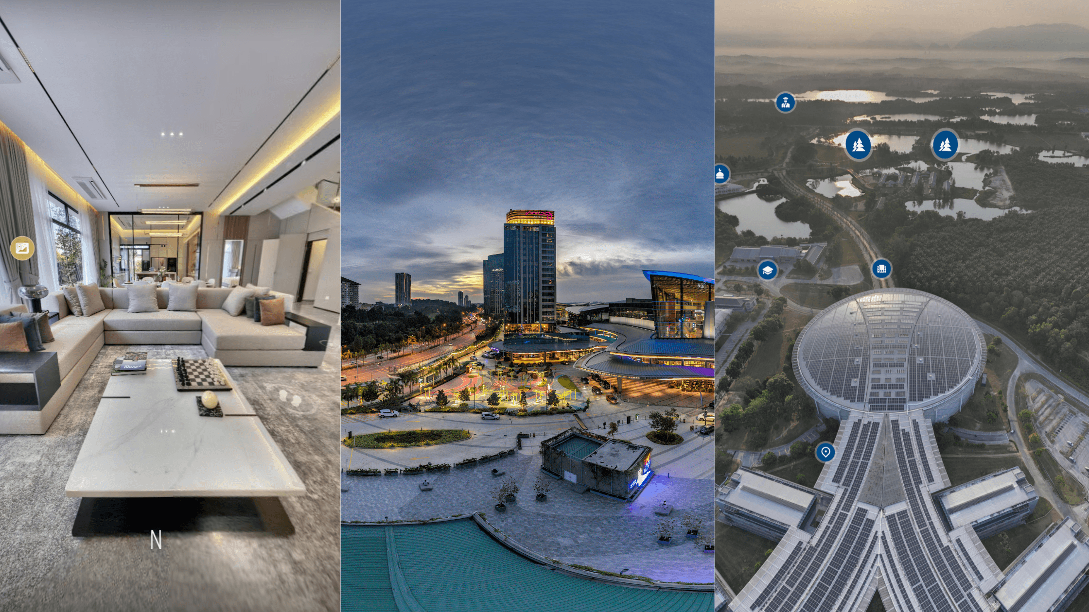
The real strategic advantage emerges when aerial scenes connect seamlessly with ground and interior views. With ground-level 360 scenes and interactive content in a single tour, people can start in the sky, glide down to the lobby, and step into a unit, warehouse, suite, or hall, all within the browser. This sky-to-ground continuum lets prospects read both the big picture and the fine detail in one experience.
For time-sensitive campaigns, this approach is also faster to deploy. You do not need survey-grade planning and processing; you need high-quality, CAAM-certified flights focused on strong angles and smooth motion. That means you can respond quickly to launch dates, new leasing pushes, and changing campaign priorities without rebuilding an entire technical dataset.
A single question can guide your decision: Do you need technical proof, or emotional and operational clarity?
If you are checking land formation, infrastructure, or exact volumes, technical aerial methods can support the wider project workflow. But if your focus is selling lifestyle, demonstrating access, and showing the lived or operational experience of a place, CAAM-certified aerial virtual tours are usually the more strategic fit.
Consider a few scenarios:
Launching a new residential tower
Use aerial virtual tours to show access roads, nearby schools, parks, retail, and skyline views, then link directly into show unit interiors so buyers can connect the external setting with the internal layout.
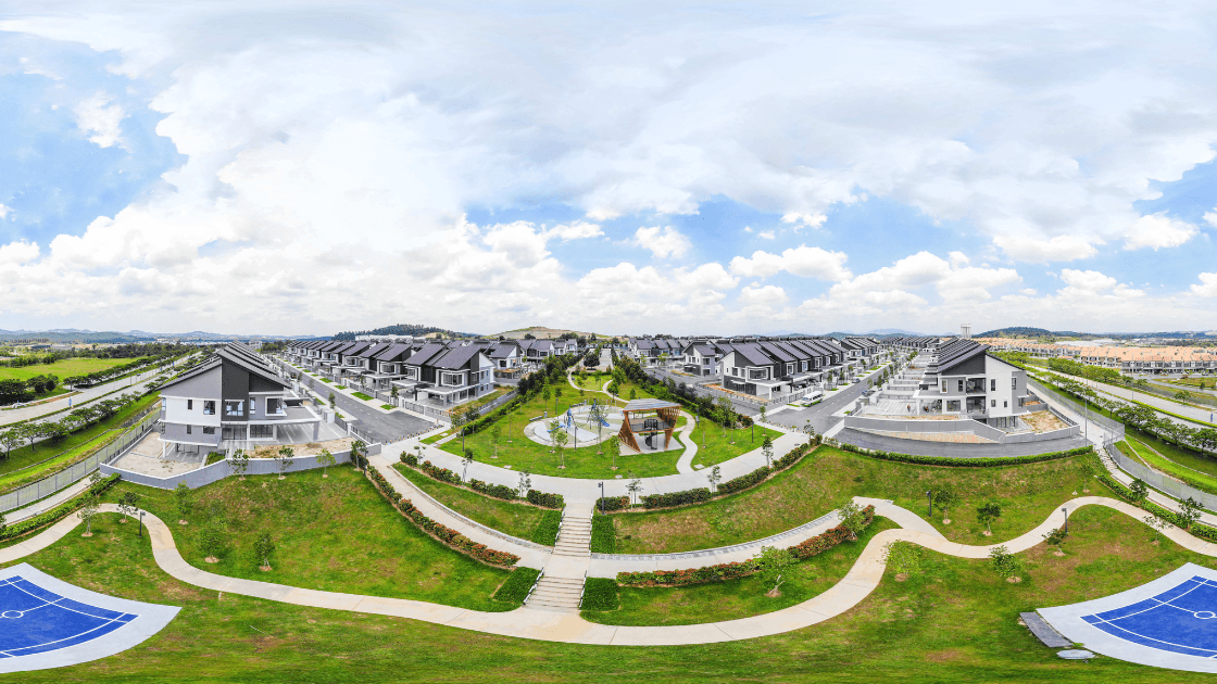
Presenting a township
Let your aerial virtual tour be a dynamic virtual scale model that evolves with your township project, showing every component as the development progresses, while allowing potential buyers to visualise the neighbourhood. These 10 Top Township Virtual Tours in Malaysia show how this can be done.
Positioning a resort destination
Focus on sweeping flights over the coastline, pools, and dining areas, then connect to room and villa tours for a complete booking journey that answers questions on proximity, atmosphere, and amenities in one flow.
Showcasing industrial parks and logistics access
Use aerial virtual tours to highlight major highways, ports, rail links, loading bays, and truck circulation, making operational efficiency immediately visible to logistics managers and industrial tenants evaluating the site.
Promoting an event campus or mixed-use complex
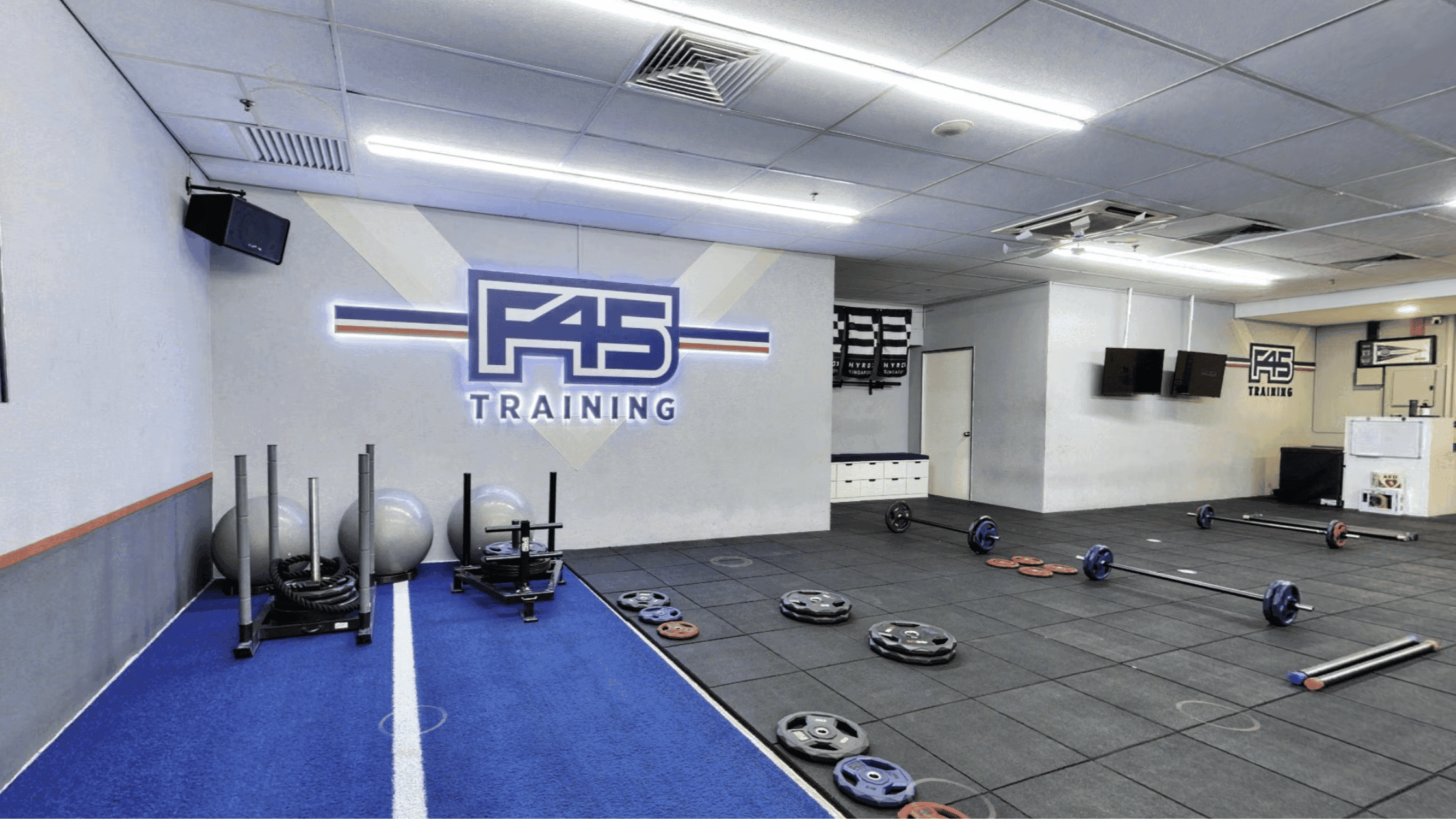
Combine aerial overviews of halls, outdoor spaces, and parking with interior tours of ballrooms, breakout rooms, retail strips, and office lobbies, so planners and tenants can map guest flows and daily movement in minutes.
Most marketing teams are tuned to work with images, video, and interactive tours. They are less equipped to handle GIS-style data and engineering formats. When you choose an agile, browser-based virtual tour built on certified aerial capture, you also gain long-term flexibility. It becomes easier to refresh scenes with new phases, landscape changes, signage, or updated branding, without redoing an entire technical model each time something on site evolves.
Read Next: 7 Industries That Benefit Most From Having 360 Virtual Tours
As Southeast Asia’s property cycles accelerate, the winners will be teams that align aerial content with real buyer and tenant journeys, not just with technical possibilities. Precision data will continue to serve planners and engineers, but marketing needs clarity, speed, and narrative.
CAAM-certified aerial virtual tours built for storytelling allow campaigns to move faster, explain more clearly, and connect more deeply with real people. Thoughtful sky-to-ground experiences help your audience understand not just where a property sits on the map, but how trucks move through a yard, how guests approach a lobby, or how residents experience daily commutes and views.
In a crowded market, that shift, from measuring the site to narrating the experience, is where aerial tech becomes a genuine competitive advantage for residential launches, industrial parks, land lots, and hospitality assets alike.
If you are ready to turn your properties into compelling aerial virtual tours, our team at Actsugi is here to help. Actsugi specialises in virtual tour presentation technology powered by 360 virtual tours and 3D virtual tours. We have experienced CAAM-certified pilots that will handle the flight from start to end, from permit application to ensuring safe flights and stunning aerial imagery for your virtual tour. Ready to explore? Let's talk.