Let's meet
Level 16, Wisma UOA Damansara II, No 6, Changkat Semantan, Bukit Damansara Kuala Lumpur, 50490 Malaysia
Discover how aerial photography helps teams see project layouts, capture details, and create engaging virtual tours with licensed drone operators.
Posted by Darrel Kim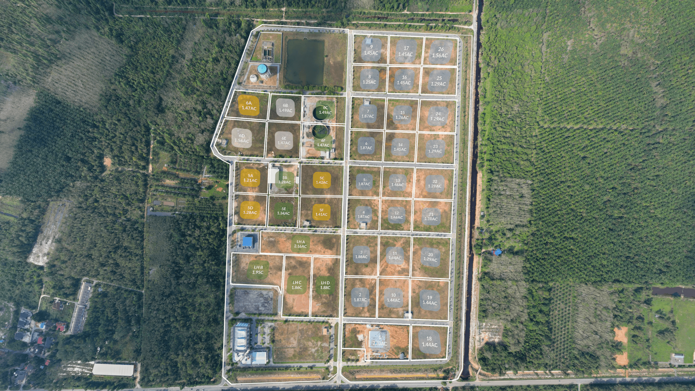
Construction projects today move fast, and decisions need to be made even faster. Seeing the full picture early can make a big difference in planning and communication. One of the best ways to get that perspective is through aerial photography. By capturing high-resolution images from drones, licensed pilots, or planes, teams gain a clear view of the site, its surroundings, and how everything fits together.
At Actsugi, our pilots are CAAM-certified, meaning we are fully licensed to operate drones and secure necessary permits. This ensures safe, compliant flights that deliver detailed visuals for any project across Malaysia.
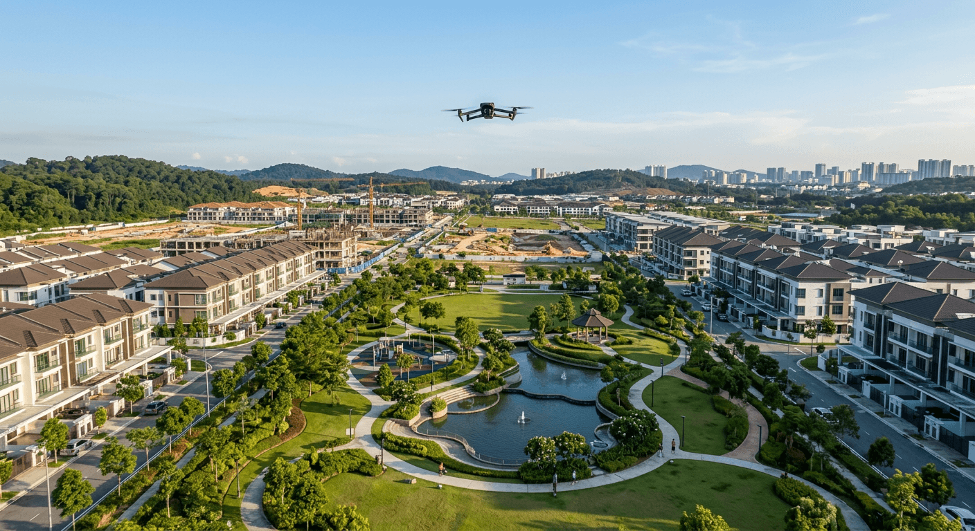
A view from above transforms how a site is understood. Ground-level perspectives show walls, corners, and maybe a few pathways, but an aerial shot reveals the full layout instantly.
This is especially useful for larger projects such as:
From the sky, traffic flow, entrance points, and pathways between buildings become clear. The images give planners and stakeholders a reliable, high-level reference for site layouts, making communication and early-stage decisions much easier.
Small details can easily be overlooked on the ground. A service road, rooftop space, or landscaping plan may not be obvious during initial visits. Aerial photography highlights these elements, helping buyers, investors, and project teams see the full scope of a site.
These visuals allow updates to be shared quickly, keeping everyone aligned without requiring a site visit.
The value of a site often depends on its surroundings. Is a school within walking distance? How far is the nearest highway or MRT station? Aerial shots provide a map-like overview of the area, showing landmarks, transportation links, and essential amenities.
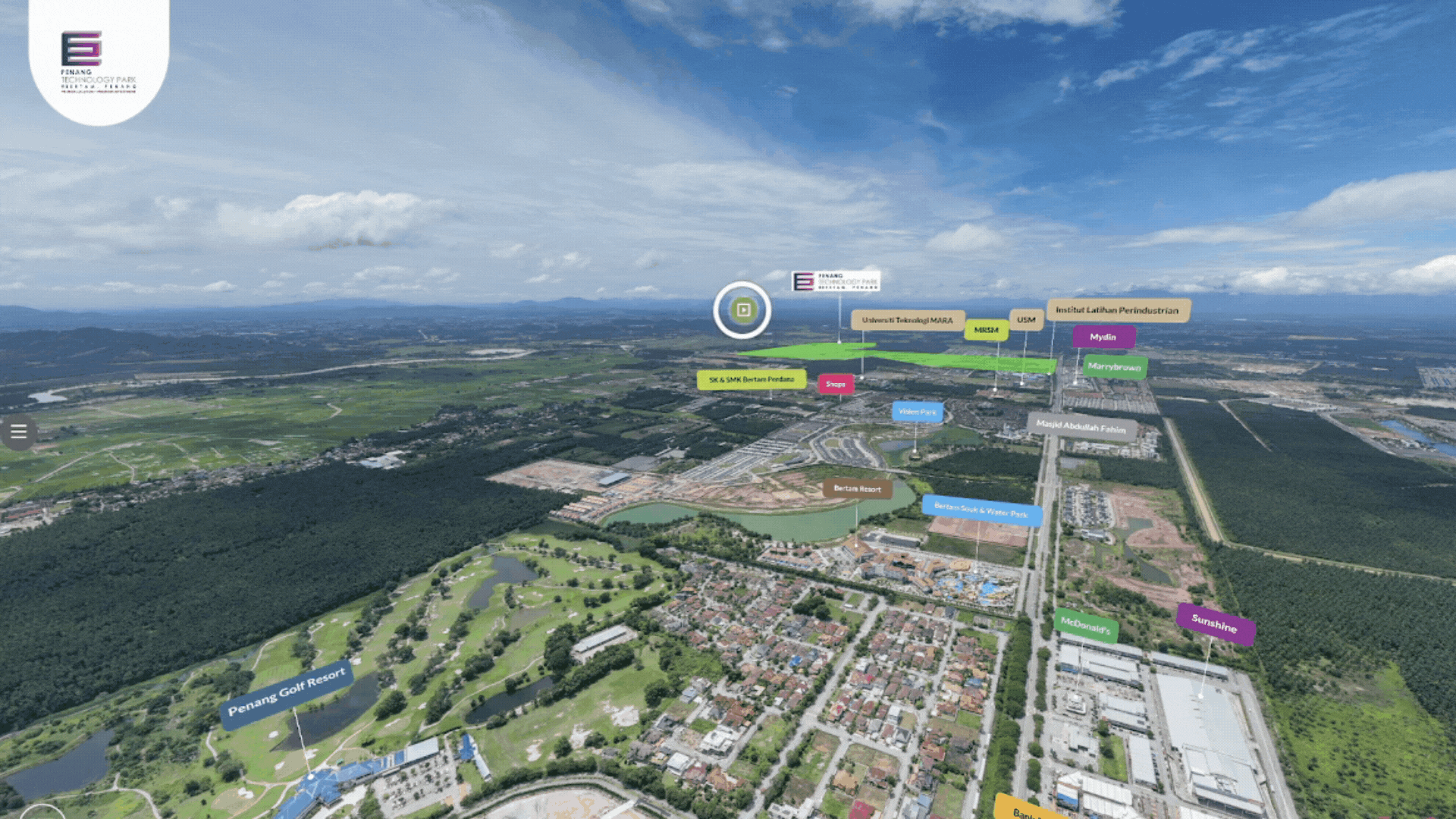
Typical aerial views highlight:
These insights help residents, employees, or investors envision daily life around the site and evaluate accessibility and convenience early in the planning process.
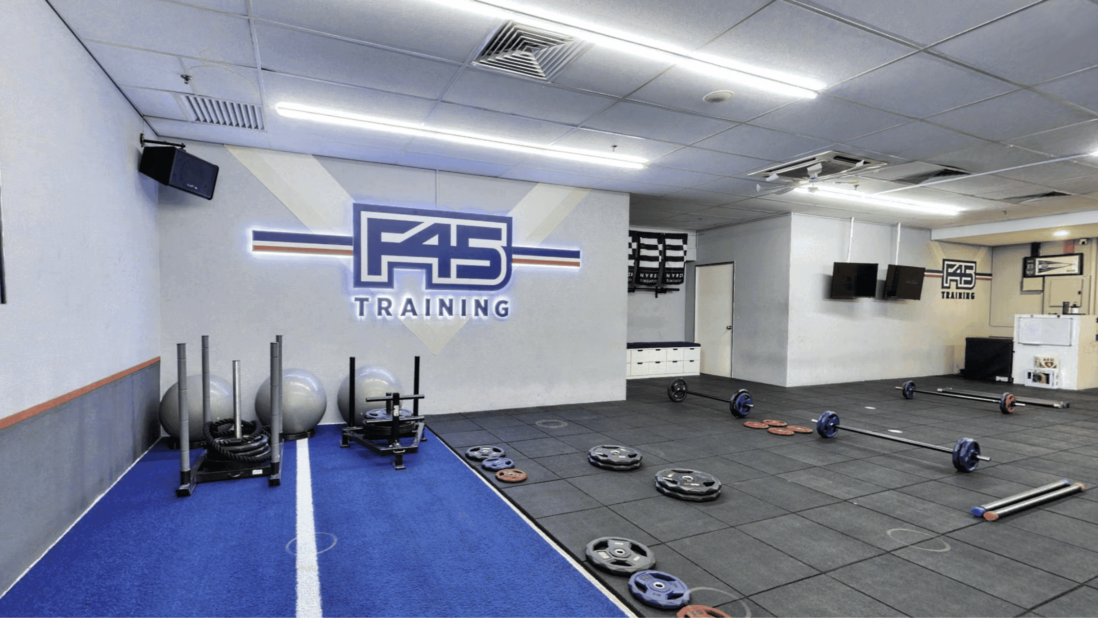
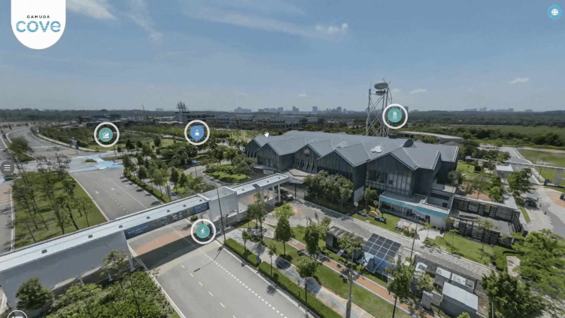
Aerial photos are an excellent addition to virtual tours. They give users context, connecting what they see on the ground with the full property layout. Visitors can:
The combination of ground-level walkthroughs and overhead imagery makes virtual tours more engaging, informative, and easy to navigate.
Sometimes, the layout and land use are the most compelling features of a project. Aerial photography showcases scale, planning, and access in ways drawings or interior photos cannot. Early-stage visuals help projects attract interest even before construction is complete.
This approach works well for:
Clear aerial visuals give confidence to stakeholders and make project updates more effective. Seeing layouts, connections, and surroundings at a glance improves decision-making, supports presentations, and boosts engagement with potential buyers or investors.
At Actsugi, we combine aerial photography with virtual tours to give clients a complete understanding of a site and its context. Our CAAM-certified pilots ensure safe, compliant flights, and our high-resolution images help projects make a strong first impression. With clear, accurate visuals from above, teams and clients can plan smarter and move faster.